With a total of 11 or so kilometers over 2 runs and virtually no sleep since
Foxtail, I headed into this one just hoping like heck I could make the first on-course cut-off, let alone the whole distance.
 |
| Mostly because I wanted to see all of the spectacular sights the course would have to offer. |
I saw my chiropractor on Monday and then again the day before the race in an attempt to address the ongoing nerve issue in my left lower back (and a popped up 1st metatarsal in my left foot) - everything had cooperated during the couple of shake-out runs I'd done, but I was quite sore. Rain fell heavily both at home and on the trail on Friday, and I hoped it wouldn't be a slippery, muddy mess. Waking up at 4:45am on race morning and pouring boiling water on my oatmeal, I splashed a drop on my left leg. I was really hoping - after what had been a really terrible week so far - this wasn't going to be another
cursed race.
We were late getting out the door, too, as I struggled to get my body taped up so it might hold together through an estimated 5,000' of climbing and countless roots, rocks, bridges, stiles, and stream crossings. I knew I'd had some success keeping my ongoing high hamstring and glute issues happier by sort of grabbing the left side of my butt and lifting it up and out, so I tried to do that with some kinesiology tape.
 |
I won't subject you to a photo, so here's a rear view drawing sans skirt.
The black indicates the tape, running from my left upper, inner thigh out to my hip |
And, of course, my usual "more tape than human" work on my feet.
 |
| I went with the same arch + ankle support applications for both feet this time |
I also used a lot of Trail Toes on my left foot as well as a heap of Blister Shield in my socks, as I hadn't quite got rid of the ill effects of
Foxtail yet.
 |
| This was the state of my left foot on Friday afternoon. |
After I'd got my calf panties, socks, gaiters and shoes on (in that order; can you believe I kept that straight before even having a coffee?), something about my right shoe wasn't feeling awesome. It was so late, though -already past 6am - that I didn't have time to fuss with it any further. After a stop at T.Ho's for much-needed caffeination we drove through darkness with the harvest moon still hanging large in the sky, until it was covered by cloud as we approached Beaver Valley near sunrise.
.
 |
| Beautiful morning |
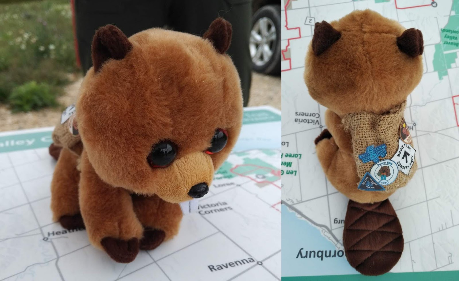
Despite a stop in Flesherton because I REALLY HAD TO PEE we still got up to the race site at Beaver Valley Ski Club a bit before 8am, which was much to my satisfaction. I was able to pick up my awesome
Happy Trails Racing x
Canadian Running Co. socks, say hello to a lot of friends who were racing, and meet some of the
Beaver Valley Bruce Trail Club members who had been instrumental in making this event happen.
 |
| Not to mention their adorable little mascot named Eager, complete with his own badges! |
After my usual flaily warmup, pre-race announcements, more fussing with my shoes (I went with my
Ultraventures for their grippy soles, but they're a bit big on me so I needed them laced down tight...but not so tight that I'd get uncomfortable pressure on the tops of my feet), another wee, and a smooch from
Tanker, Race Director Jeff had us all line up down by a beautiful creek for the start. I knew the opening out-and-back was up a ski hill, so had my poles ready to go.
 |
| Wimp sticks and allllll the food & water. |
With aid stations not less than 6km apart and stretches up to 8km without aid, I'd decided to go with a hydration bladder instead of my usual hand bottle as I knew that the trail would be very technical with lots of elevation change, and I didn't want to run out of water. While I'd ordinarily be able to get away with adding a soft bottle, I'd actually need all of the pockets I had available for nutrition: the race had a cut-off of 11hrs, and I expected to take most of that to finish it. Food allergies really suck, as it meant I couldn't rely on snacks from the aid stations to keep me going; with no drop bag provisions that meant I'd need to carry at least 2,200cal worth of assorted food, which is about what an average person eats in a day, or equivalent to 22 gel packets. I also wanted to be able to have hands free to scramble up rooty, rocky climbs if necessary - I'm not above crawling or butt-sliding my way around a course if that's what it takes to get me there safely.
Bang on 9am, Jeff said go, and we all sort of meandered away from the start. Noone seemed to be in much of a hurry, though as we crossed the bridge we did finally break into a run.
 |
| When running, I hold my poles toward their middle so they're better balanced. |
 |
| Knowing my place, I started off at the very back. |
Within moments we were, in fact, beginning to climb along the foot of a ski hill. I also rapidly realised I wasn't going to be happy with having both poles in my hands - I wanted one hand free for my phone to take photos!
 |
| Just the beginning - still somewhat runnable. |
It didn't take me as long as I'd expected to get one of my poles folded up and hooked to my pack - I'd originally planned to use one that has the pole attachments in front just for this sort of situation, but it wasn't comfortable with a water bladder (which I found out Tuesday of race week - sure glad I loaded it up with all my food and tried wearing it around the kitchen for awhile). I thought I'd have to remove the VaporAiress to get the pole looped in on the back, but it turned out I could just un-clip it (not even sure that was 100% necessary), put the top loop around the grip end of the folded pole, then reach back and loop the bottom elastic cord over the tip end. It sat right against my back and wasn't perfectly comfortable, but I shoved it around with my elbow a bit until it found a less annoying position. Now, back to work.
 |
| Hup hup hup |
 |
| You'd turn a corner, and the damn hill would go up again. |
 |
| Sometimes even more steeply. |
I was getting a little concerned about my calves already: since I'd started running again (that is, Monday of race week), my calves had been super tight and sore. As I strained my way up the ski hill, the pressure on them was immense, and I was basically just waiting for them to cramp or feel the pop of a tear. All this and I wasn't even a kilometer in yet.
 |
The last hill section - the trail begins at top right.
You can just barely make out some specks that are in fact other runners turning onto the trail. |
Fortunately, the compression from my calf panties kept anything from exploding - I even passed a couple of people on my way up, though I was just moving however felt best - and I was still functional for my first taste of the Bruce.
 |
| Which started off gently. |
 |
Then went up again.
It would be rather a theme for the day. |
I has just barely made it to the trail - about a kilometer and a quarter in - when the first runners started to come past in the other direction, already having made the turn-around.
 |
| There was some nice flowy trail in the woods that was actually runnable, even for my slow, clumsy arse. |
 |
| I eventually made it |
Heading back, I was already past the 30min mark, so after offering an encouraging word to the very few people behind me I started to take in some nutrition - a swig from my flask of
EFS Liquid Shot, plus an
S!cap for some prophylactic electrolytes.
 |
| Emerging from the trail again |
 |
| Down we go! |
While running down the ski hill - just barely in control on the steep, grassy slope - it became apparent that the idea was to completely destroy your quads before feeding your battered carcass to the
Bruce Trail.
 |
| Though it did offer a nice view, even from the bottom. |
Across the bottom of the ski hills, then back across the bridge that had started the day.
 |
| Diving was not in my plans, but thanks for the heads up. |
When I came through the starting area, there was noone around - Tank had already headed out to Aid Station #4, which I wouldn't see until 31km into the race. I wasn't carrying the apple for another ~25km, so I just set it on a handy picnic table by the stream and got on my way.
 |
| Oh look, a flat bit! |
 |
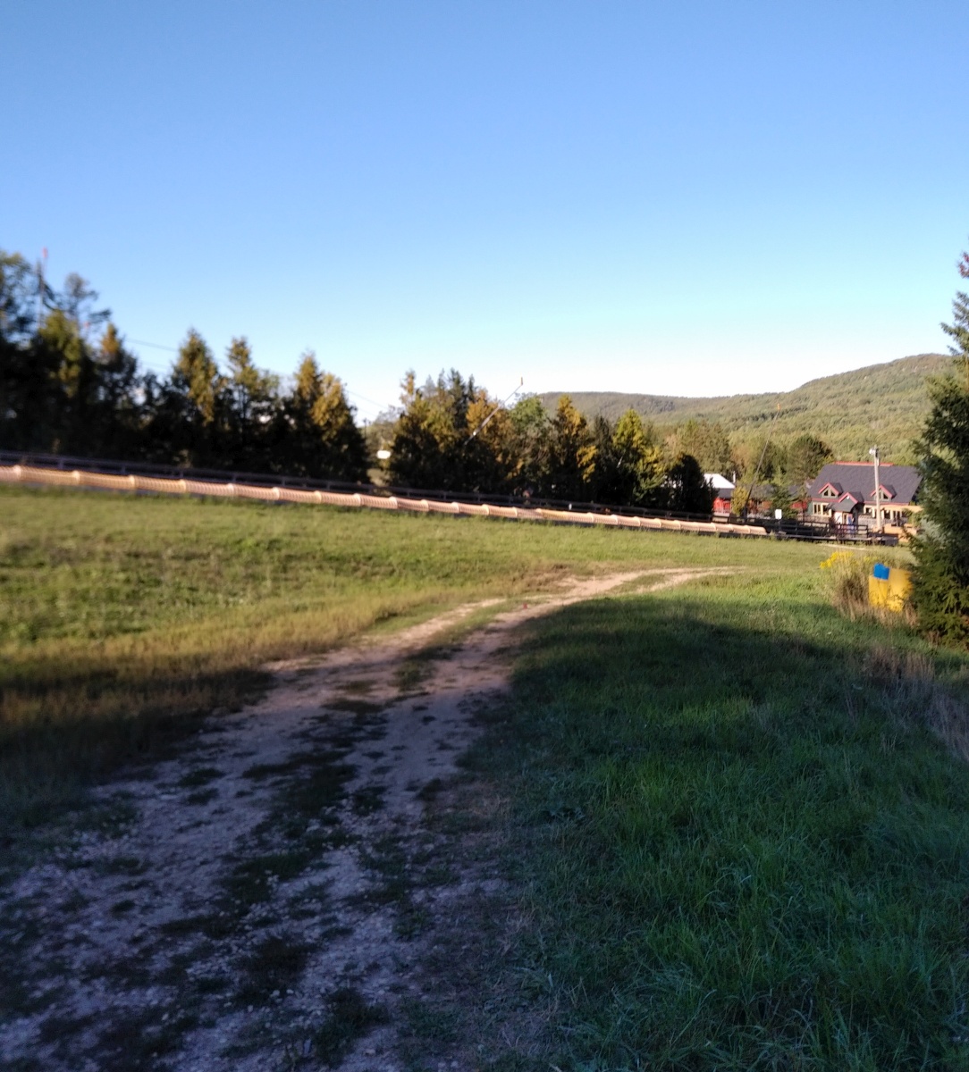
| Out onto the gravel Beaver Valley Ski Club driveway |
You run right out through the gates of the ski club, where Event Co-ordinator Byron was waiting to direct runners across the road when safe. Directly opposite the driveway on Grey County Road 30 was another trailhead leading to the Valley Crossover Side Trail.
 |
| This way to meet my fate. |
In keeping with the character of the race, the first thing that greeted us was basically a scree wall.
 |
| A bit silty from the prior day's rain |
 |
| Winding its way through the fallen trees and branches |
In a totally unexpected twist - and while I munched on a homemade salted maple crisp rice square - the trail went up again. This time, however, it was more of a talus field than a trail.
 |
| Goodbye ankles - nice knowing you. |
 |
| Alleyoop |
At the top was a really neat sedimentary rock formation.
 |
| I hoped to see it up close before dying. |
Sue Sitki -
course photographer extraordinare - was on top of the rock formation, which fortunately gave us a rather more achievable way to climb it.
 |
| A volunteer attempts to kick the strewn chips off the road. |
Having made the first 8k in 1h25m, I was feeling slightly more comfortable with the rolling cut-offs as I was now 50mins ahead of the 2h15m deadline to arrive at AS1. I filled my pack with water for the next 7km segment, grabbed & ate a chunk of banana, threw back a cup of
Skratch, thanked the volunteers, then headed a bit further up and back across the road to continue along the main
Bruce Trail.
 |
| It sure wasn't looking like a nice day, though. |
 |
| Kristi - whom I met on course and spent some time near at various points - climbs the first stile. |
Up on top of the east ridge above the valley, there are some really neat rock formations.
 |
| ..and a trail that runs along the edge of a cliff. |
 |
One heck of a view, though the wind kept me from going too near the edge;
there's at least a hundred foot drop below |
It was around this time I decided I'd better put my phone in aircraft mode to save its battery for photos. I did have a powerbank with me, but I didn't anticipate needing my phone for anything other than photography, and could just as easily take it out of aircraft mode if I did. Having another swig of
EFS Liquid Shot and another
S!cap around 1h35m, we climbed further up, over some fairly technical terrain.
 |
| Like this, or at least a portion of it until I was too out of breath. |
 |
| I mean, I had already climbed up here from the valley's floor. |
 |
| ..and would continue to climb some more, just for giggles. |
The infrastructure of the trail is in incredible condition thanks to the efforts of the
Beaver Valley Bruce Trail Club. All of the stiles, bridges and boardwalks I encountered were in great shape!
 |
Like this bridge over a then-dry runoff stream.
I'm sure it's a raging torrent during the snowmelt! |
We also started to get into some stream crossings here and there, which I took very carefully as I know how slippery the wet rocks can be.
 |
| Also see: clumsy oafishness. |
 |
| And don't fall off the cliff, K. |
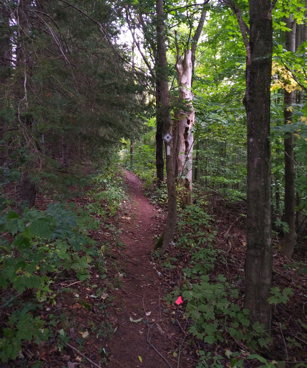
Turning uphill once more, the trail became rather overgrown - all manner of low-lying plants whipped at my legs as I passed, but the trail was actually quite runnable for the moment.
 |
| I'd need to do a tick check later, though. |
Emerging from the forest, you turn uphill again - why am I surprised? - along a hydro line.
 |
| By which I mean back bacon. |
The grassy trail widened near the top as you approached the two towers, which I hear have something to do with hydroelectric power generation but about which I have no specific information.
 |
| Other than "you have to go up past them and turn right" |
Rounding the towers, you turn back downhill with an impressive view of the valley before you.
 |
| Especially when the sun decides to shine! |
Left at the fence, then along the side of the massive hill on another grassy section of runnable trail.
 |
| Hmm, we get to go downhill on a road? |
 |
| Oh. This. |
There had been some talk in both the pre-race email and the raceday announcements about this section - the
Campbell's/Graham's Hill Side Trail, which we'd do twice as we wound our way through the figure-8 course.
 |
| Map from the pre-race email |
So, you start to run downhill. Like REALLY downhill, in a way I knew was shredding my quads even more than the ski hill descent.
 |
| The descent is actually a bit steeper than the climb, but your legs would never know it. |
 |
| Mrph. |
Scarfing back a
chocolate chunk granola bar and another
S!cap around 2h30m, I discovered this was another one of those lovely beasts that makes you think you're nearly to the top before rounding a corner and climbing yet further.
 |
Keep in mind going forward - there is no overlap to these photos.
You can't see the next section from the photo before. |
It's not without its attractions, like a little gravel spill from either a spring or stream.
I'd made it in 2h45m, just catching Kristi on her way out of the aid station - the first time I'd seen anyone else in about an hour - and well ahead of the 4-hour cut-off time to reach this point. I drank a cup of
Skratch, filled my pack with water, dropped off my rubbish in the bag provided, and got on my way before I started to cry about my stupid food allergies preventing me from taking part in the delicious-looking spread of baked goods. Over the stile behind AS2, I was into one of the slowest - but most spectacular - portions of the course for me.
 |
| Ooh! OOH! I can run that! |
 |
| ..but not that. |
Out of the forest once more, you hook right into a sun-drenched meadow.
 |
| That continues to climb, but what did you expect? |
 |
| Autumnal blooms in full effect |
The grassy trail flattened out and continued for a couple of hundred metres. I ran as best I could, but I find grass takes a lot of energy to run through, so I did walk a few steps to try to catch my breath.
 |
| It had been a long time since my 5:30am oatmeal. |
 |
| I declined to add mushrooms to my wrap. |
With the pounding of the ski hill from the opening out-and-back plus the Campbell's/Graham's Hill crossing, I was actually finding it more comfortable to run down any hills I could than to walk down them, as my running stride seemed to cushion the impact to my quads better than stepping down. Unfortunately, a lot of the course still demanded that I walk it, lest I trip and take a tumble almost sure to injure me. I actually found one of the only muddy spots on the whole course here, but there was a higher, dry section of trail beside it so noone had to get their pretty little shoes dirty.
 |
| Some people had certainly gone right through it, though. |
 |
| More runnable trail - w00t! |
I could hear flowing water that seemed significantly larger, so wondered if I was nearing Hogg's Falls - I knew that Aid Station 3 was in its vicinity, around the 23k mark. Instead, what I found was another stream crossing with a rather more dramatic flow.
 |
| Gorgeous |
 |
| Such silty water from the rainfall! |
 |
| More slow going over mossy rocks |
Nearing 4h30m it was time for another
Endurance Tap gel and an
S!cap, with ample opportunity at my slow pace.
 |
| Downhill, then hook left to follow the stream |
 |
| Nothing lovelier than a sunlit forest |
 |
| Emerging at Grey Highlands East Back Line |
Popping out of the woods, I turned left to find AS3 manned by Shannon L. and her helper. I was at about 4h40m - the last 8km had taken me almost 2 hours, and I knew I had another 8km to go to the next aid station. So, I filled my pack as full as I could, having to enlist Shannon's help when the slide-to-seal plastic piece of the bladder refused to budge past halfway when closing it. With it eventually freed and properly sealed, I got rid of all my rubbish, drank a cup of
Skratch, ate another banana chunk, and thanked Shannon and the young lad with her for their help and generosity in volunteering.
 |
| Out on a lonely road in the middle of nowhere. |
Then it was time to get moving again, this time down a flat, gravel road. There was no way I was walking this, despite now having gained a few pounds of weight in water from filling my pack and the powerful sun beating down from above.
 |
| Not a scrap of shade to be found. |
I was also having a bit of trouble from the giant blister on the ball of my left foot, though not directly - the blister itself felt ok, but the Ultraventure shoes I'd chosen don't have a rock plate in them. There were a bunch of chunks of 1" stone on the gravel road, and when I'd accidentally step on one with the ball of my left foot while running (which means landing with a force approximately 3 times your bodyweight), it would be excruciating. So, I tried to be careful.
 |
| I was truly only seeing a tiny piece of the Bruce Trail today. |
 |
| A bridge on the gravel road took us over this lovely little stream, where a man sat fishing. |
Back into the blissfully shady woods with a left turn just after the bridge, the trail followed the stream as it began to climb.
 |
| Right at water level |
 |
| More stairs |
 |
| Climbing a bit more |
At a fork in the trail I heard
Sue Sitki direct me to take the lower path, which took me past Hogg's Falls.
 |
| Totally worth a small diversion. |
Sue also had her camera set up, capturing photos of runners just before the falls.
 |
| On a downhill this time, so I was actually running! |
Of course, the sting in the tail was that we now had a short but steep, washed-out climb to get back up to the main trail.
 |
| Some roots and loose stone just to make things interesting |
From there the trail was a wide gravel path for a few metres, then you cross Lower Valley Road (the gravel road I'd run in on, that runs the length of the bottom of the valley) and things get more interesting again.
 |
| Boardwalkin' |
 |
| Long uphill on shared horse trail |
I used the hill to get some more
EFS Liquid Shot into me - I had 2 swigs left and wanted them gone before I reached Aid Station 4, where I could drop off the empty flask with
Tanker, so had one at 5h and another at 5h30 with an
S!cap. Somewhere in this timeframe I also needed another trailside wee, so it was clear I was staying on top of hydration.
 |
| At least it was shady this time! |
Turning back onto the trail, it was clear I'd been a little too optimistic in my assumptions, and it would take a little more time.
 |
| Strongly suspect this "42.2km" course has some - ahem - added value to it. |
The trail - you guessed it - began to climb immediately.
 |
| Sun-baked dirt singletrack that reminded me of the switchback hill at Sunburn Solstice |
 |
| STEEP |
 |
| Back on top again, with the sumac blazing red under the sun |
In stark contrast to the parched dirt in the open areas, turning back into the forest led me past the only other muddy patch I saw all day.
 |
| Again with plenty of room to go 'round it |
As I munched another salted maple crisp rice square, the trail widened out and continued to climb, with large swaths formed of washboard-like sedimentary rock.
 |
| The hills showing their bones |
There was some cliff-edge trail with impressive cedar trees jutting out over the edge, and further rock-strewn climbing through confierous forest.
 |
| Truly beautiful, if a bit tough. |
Then the trail joined a wide, fairly smooth path that climbed some more to the top of the ridge.
 |
| Easier going. |
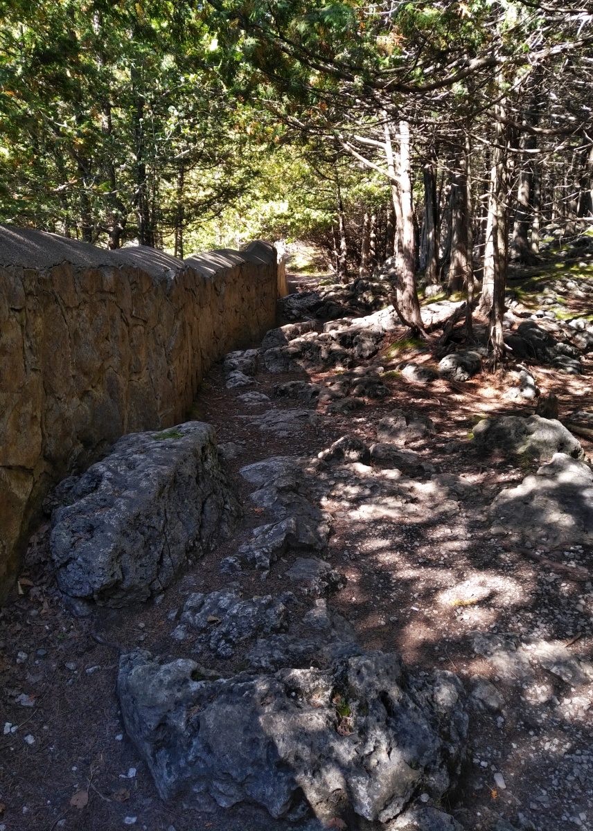
Emerging from the woods at a stone wall, I was rewarded for my efforts with a view of Eugenia Falls over Cuckoo Valley.
 |
| The photo does it no justice at all. |
A right turn to continue along the stone wall led to some really rocky trail - there was no way I was running this!
 |
| Some people did. They're much braver - or much less clumsy - than I. |
 |
| Impressive view down the valley |
 |
| Beside the falls - the rock walls on the far side of Cuckoo Valley are incredible! |
 |
| Looking a bit to the right of the last shot at the rocky plateau from which the falls plunge |
It was a bit disappointing that we didn't get a closer view of the full falls, but such is life - the trail turned away from the rock wall and through a grassy field to the ruin of a stone building.
 |
| Couldn't tell you what this was in its past life. |
That was the last of the smooth, runnable trail for awhile - as we followed the Beaver River above the falls, the terrain was covered with mossy rocks over which I had to carefully pick my way.
 |
| I was trying to keep my ankles intact...or at least as intact as they started the day. |
 |
| Rapids in the Beaver River |
 |
| Such a beautiful spot |
The trail came out at a groomed, sloping gravel pathway that took you over a bridge high above the river - even I could run that bit!
 |
| There was also a road bridge to the east - Beaver Valley Road, to be precise |
..which landed me at Aid Station 4 around 6h27m, with
my honey gettin' his groove on!
 |
| Shake it don't break it |
While it was only 6km from there to the next aid station, I filled my pack to the brim once more (with no sealing issues this time - of course it cooperates when I have Operation Brute Force there to help me) as I'd heard it was some of the most challenging trail of the whole course. I dropped off my empty gel flask with Tank and ditched my trash, but decided to hang onto the second pole (still strapped to the back of my pack) in case I needed it to navigate the next section. I also kept the pair of little stretchy gloves, wind jacket, and powerbank I'd stowed in my pack if I needed them: I didn't want my phone battery to die with the sheer volume of pics I was taking, and I also had my Garmin charge cable to use with the powerbank in case it gave me a low battery warning. Heck, the powerbank also functions as an emergency light, so if I was caught out after dark I wouldn't be screwed.
 |
| Because navigating this in daylight was difficult enough, thank you. |
I grabbed a cup off the table and drank a mouthful, only to discover it was water. Whatever - I drank it anyway, then drank a cup of ACTUAL
Skratch, ate another chunk of banana, got a smooch from
Tank, and got on my way again as I popped another
S!cap for good measure. I had hopes of coming in under 9hrs, but I was still 11km (ish? It was hard to tell with my Garmin reading long) and the toughest technical section away from the finish, and I certainly wasn't feeling terribly fresh at this point.
 |
| Not that I'd be able to run this even if I was! |
I passed a big stone archway that I heard something about having been built in the goldrush days, but about which I have no solid information.
 |
| There is a hydroelectric dam somewhere in the area, but this doesn't look to be associated. |
The the trail turned right just beyond it (to the left in the photo above, where the sunbeam is) and things got awfully steep again.
 |
| Those topographical lines are all cuddling together again |
 |
| Mrph |
 |
| IT JUST KEEPS GOING |
I came to a fork in the trail and paused as I examined my options: the lower path looked safer, but had a sign a few feet down it that said "no access beyond this point". Looking to the right, I saw...well...a scree wall.
 |
| MRPH |
I figured I must be wrong - there's no way we had to climb that, right? A gust of wind whipped through and tried to blow me over as I stood on the near-vertical, loose, stony slope.
Then I saw the little flag high above..
Bugger.
I'm not ashamed to say that I basically crawled up the scree. My knees didn't actually touch down, but I was definitely using hands to grab whatever root or tree I could find to keep me from slipping backwards or falling - call it a bear crawl, if you will. I'm still not 100% convinced I went the right way, as I've heard someone mention they almost blew a turn around this point (so I may have done the same - there might well have been an easier way up), but I did eventually make it up to the flag I'd seen, and onto slightly less treacherous trail.
 |
| Still rather vertical but at least there are roots to stabilize the soil - and my feet! |
Easier being relative, of course - as I made my way up, I felt something give a mild pop in my right calf, and hoped I hadn't just messed myself up badly. It kept functioning, though, and fortunately I haven't heard anything from it since. I'd had some warning creaks from the adductors in my right leg, but fortunately the left (which had suffered the nerve damage and caused me so much pain at
Foxtail) was holding in there, and seeing nothing but blue sky beyond the thinning trees meant I knew I was reaching the top once again.
 |
| Lovely view over the valley again, but I still wasn't sitting down. |
We got to run along the ridge for a bit, on some fairly buffed-out trail that even my clumsy arse could manage.
 |
| WHEEEEE |
Then another right turn to head downhill, past another of the inexplicable stone arches.
 |
| This one at maybe 45m higher elevation than the last? |
I did my best to run down the hill, but it was quite steep and still quite festooned with roots.
 |
| Some of which were difficult to see in the dappled sunlight through the leaves. |
I made it down safely, though, emerging onto another gravel road almost exactly at the 7hr mark.
 |
| North Road, apparently |
A few metres of running brought me to another trailhead leading north.
I stopped for a quick trailside pee - I was definitely staying hydrated - and then a couple of minutes later Kristi appeared behind me! I wondered how the heck I'd got past her, but she explained that she had blown a couple of turns along the way and had to backtrack. I felt awful for her, as it was certainly a tough enough day without any additional mileage...but was kinda happy she hadn't been subjected to my bare fanny hanging out.
 |
| AWW DANG |
Yep - it was
that time again. While I'd somehow got it in my mind that the figure-8 course meant we'd go the opposite way the second time, I was totally wrong - I hear I wasn't the only one who failed to realise we'd be westbound both times.
 |
| Though this time we actually started a bit higher up on Campbell's Hill |
 |
| ..which did even more damage to my already-sore quads. |
 |
| Speaking of quads, a whole group of them - plus some dune buggies - passed me as I ran down into the valley's floor. |
Crossing the bridge over the Beaver River by Lower Valley Road once more, it was time to head back up Graham's Hill.
 |
| Might not be the biggest climb of all, but it sure feels like it |
I'd ask Race Director Jeff after the race if he figured my assessment of Graham's Hill being about equivalent to 3 Martin Road climbs (of
Sulphur Springs infamy) stacked on top of one another was correct - he'd tell me that it was probably closer to 4 or 5 of them, as Martin Road is less than 400m long whereas this climbed steadily for more like a kilometer and a quarter or more.
 |
| For reference, that little red speck up above is Kristi's hydration vest |
 |
| I stopped again to admire the view from opposite the switchback.. |
 |
| ..of which I actually got a half decent pic this time. |
 |
| Kristi had done UTMB 2 weeks prior, so her tired legs allowed me to catch up a little as we approached the aid station |
Back at AS2 - which was now Aid Station 5, but still manned by kind
Beaver Valley Bruce Trail Club volunteers - I was right around 7h40m with a bit more than 5km left to go. From the course map in the pre-race email, it also looked like this final stretch would be about the fastest of the whole race, and it seemed like I still had plenty of water in my pack.
 |
| Last stop before the end. |
I'd thrown back another
S!cap and an
Endurance Tap gel on the way up, but drank one last cup of
Skratch just to stay ahead of hydration in case my estimation of my water supplies vs. the time I'd need to finish this off turned out to be too optimistic.
Then, I buggered up completely. All set to go, I climbed the stile behind the aid station, and started off on the other side...when one of the volunteers called out that I was going the wrong way!
Dangit.
Fortunately I hadn't got far, so climbed back over the damn stile and was directed to the northbound trailhead on the opposite side of the road from AS2/5.
 |
| OK FINE - we'll do it your way. |
The first few hundred metres were quite runnable, and I was just barely able to keep up with Kristi.
 |
| Also: I was NOT running down that. |
I heard rushing water again, and rounded a corner in the trail to see this stunning fall.
 |
| Yowza. |
I heard later that there was actually a house at the top, but I totally failed to see it.
 |
So instead you get this amazing photo I shamelessly lifted from Steve F
(a.k.a. Viking Steve) |
Continuing downhill, there was another stream crossing over a tributary of the waterfall's flow.
 |
| Tell me that the couple of rocks to the left don't look like a panda! |
More steep downhill lead to the man stream's valley.
 |
| With a wedding reception going on at the property to the left. |
A left turn onto Grey County Road 30, the pavement a bit jarring to all my senses after hours of trails and gravel.
 |
| Please don't make me run up this. |
Across the road, then things became a bit unclear. I started to walk up the side of the road, popping a final
S!cap as my fingers were a bit sausage-y, then saw a flag on the other side of the guardrail, so stepped over and onto a narrow gravel path that led over a rocky pair of culverts.
 |
| Straight into the sun - it was now almost 5:15pm |
A
Beaver Valley Bruce Trail Club volunteer directed me down the steep, sketchy little steps to the another stile.
 |
| NOOOOOOOOOOOOO |
Fortunately, blazes, arrows and tape directed us to turn right and dive back into the woods again instead.
 |
| Which is not to say there was no climbing |
 |
| Oh yes, very nice - along the creek |
Of course, it couldn't be that easy. With my Garmin telling me I'd already done more than 42km, the trail turned steeply uphill once more. My stomach had given me a massive growl of hunger around 8h15m, which I had ignored because I figured I was close to the finish. Now at 8h30m with no end in sight, I munched on a final crisp rice square to keep myself from gnawing on my own arm.
 |
| I needed fuel for this! |
 |
| *gasping* |
This finally spat me out halfway down a ski hill.
 |
| Another crowd of topographical lines. |
 |
| Oh let me guess.. |
 |
| The green sign reads "Lazy Loop - Easiest way down" |
 |
| ..and yes, that's the way the flags said we should go. |
The final downhill actually reminded me quite a bit of the ski slope downhill at the end of the
2016 Fatsss course. Being a downhill on fairly non-technical terrain (though there was a bit of loose, washed-out stone here and there), I stirred myself into a run once more.
 |
| I was actually surprised by how strong I was still feeling even more than 8 hours in |
 |
| This gravel really sucked to run over, though |
Coming past a bunch of slopeside cottages and a line of trees, I was starting to see some more familiar-looking ground ahead.
 |
| Vague memories of the morning.. |
Down the ski slope and into another section of relatively flat, runnable trail.
 |
| Yep, definitely remember doing this once before. |
The sketchy step down over a little drainage ditch, then run across the bridge where Race Director Heather stood clapping and cheering.
 |
| AM I FREAKIN' DONE YET? |
Then into the parking lot at Beaver Valley Ski Club and toward the rainbow flag-adorned finish chute.
 |
| Kristi actually waited for me at the finish - that's her in the parking lot at right |
Kristi said we'd spent so much time together on course that we might as well finish it off together, which was kind of her. We sort of blew the entrance to the chute, though, so I ended up having to backtrack a bit within metres of the end - Kristi joked that she'd jinxed me, as she was the one who was blowing turns out on course! Eventually I got myself sorted out and she ran it in with me, generously saying I was moving too fast for her! Finally, with my Garmin reading 43.4km and having taken over 5hrs more/approximately 2.5 times longer than the race winner, I made it across the finish line.
 |
| I can haz collapse now? |
Official time: 8:41:23 @ 12:21/km
66 / 68 Finishers - 20/22 Women
 |
| ..which is actually a compass! |
Final damage tally was pretty minor: I'd caught my toes on roots and rocks a few times, but had never really tripped enough to even make me deploy the interpretive dance moves. At one point my right ankle had crunched a bit under some severe dorsiflexion while going up a steep hill, but it wasn't really any more painful than it had been going in. I hadn't fallen, I hadn't really gone off course, and I'd taken 633 photos along the way. Yes, I cut that down significantly for this post.
 |
| Me, my medal, my badge, and my honey after the race. |
I'm pleased that I was still able to run fairly strong even after 8 hours of working fairly hard on challenging terrain, though my quads still haven't quite forgiven me completely for all the steep downhill pounding, even 6 days later now. I only came in ahead of 2 people (who had kindly hung back to stay with another girl who DNF'd at AS4), but I'm grateful nonetheless that my body allows me to see such beautiful places, even if rather slowly.
I'm also immensely grateful to Jeff and Heather of
Happy Trails Racing for giving us the opportunity to see this whole stunning section of the Bruce Trail with support along the way - it would be impossible for me to carry enough water to do the whole thing on my own - and to the
Beaver Valley Bruce Trail Club for allowing us to come play on their gorgeous trails. Big thanks also to the aid station volunteers who waited so long for me to drag my butt out to them so I could stay hydrated!


