Sunday, August 30, 2020

411 for the 905

 A friend recently asked me for some information about the trails in Mississauga.


Something I know a bit about.

So, I figured I'd compile a list of the bits about which I have some knowledge, as it stands to reason someone else might be interested in the same information at some point.

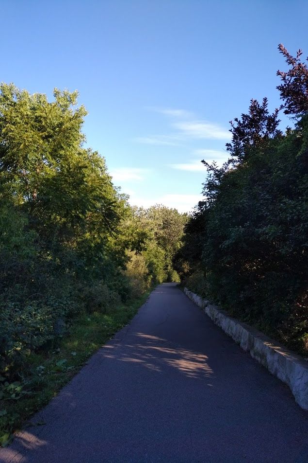
Culham / Davidson Trail

Now, full disclosure - I've only run this once, and it was more than 3 years ago (back in June 2017), but it was a nice venue for a shorter-distance run at the time. 

Map taken directly from my Garmin data


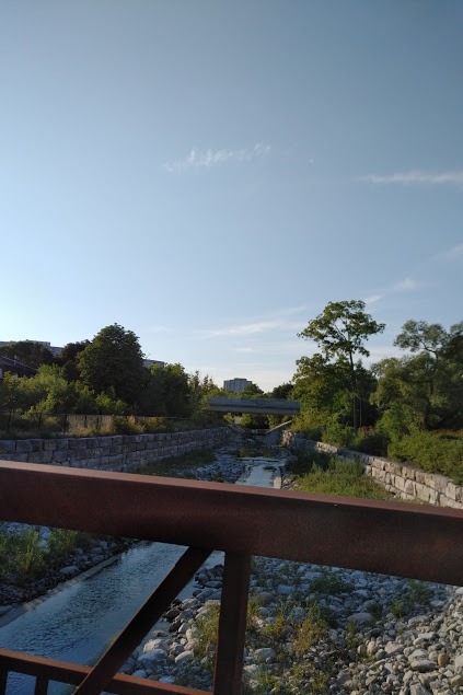
I parked at the offices of Credit Valley Conservation and headed north from there, across a beautiful footbridge over the Credit River, along a mixture of paved pathway, crushed gravel, and into some doubletrack with a tiny creek crossing up near the 407. It was relatively flat except for one hill about 3/4 of the way out, and entirely runnable.


Also highly enjoyable - not totally sure why I haven't gone back!

Applewood Trail

This is another one I have only run once, back on Easter Sunday in 2018. 


This preceded an Easter visit to my mum, and was done while wearing bunny ears!


Having only seen it in early spring, it was neither the most interesting nor the most scenic trail. Paved along its entire length and bustling with families out for one of the first nice afternoons of the year, it wasn't exactly what I'd hoped for, but was probably better for me than the uncertain surface of single- or doubletrack while I was still recovering from my catastrophic ankle injury.


It's also very well marked, so there's no chance of getting lost.


I parked in the parking lot of a buffet restaurant on Dixie Rd and ran west along the trail, doing the tiny loop at the end and running all the way back. It was again fairly flat, and would be great for putting in some fast miles...assuming it wasn't too busy. 


Also assuming Etobicoke Creek was behaving itself - it runs a tiny bit close to the trail in spots!


Etobicoke Creek Trail

Full disclosure - this is one I haven't (yet) run at all. 


They claim it's 11km, but this is all I could find on the map


From what I can gather, this would be very similar to the Applewood Trail in that it's mostly paved and tree-lined, following Etobicoke Creek. Reports say there are some small hills, but it would seem to be entirely runnable, and reviews say it stays nicely shaded in the summer; great for a hot, sunny day.


Photo taken from this site detailing improvements made to the trail


Chinguacousy Park & Surroundings

This is another one I haven't actually done, in Brampton rather than Mississauga (but close to where my friend will be working, so I'm throwing it in here for her, and also for me to check out the next time I'm down that way!) 

Seems like a decent stretch for a longer run


Of course, I'm again going by what I'm able to glean from the interwebz here, but this seems to be another mix of paved & crushed gravel pathway. I see reports that some of it can be a bit overgrown, signage isn't the best, and the creek it follows has been unfortunately relegated to a cement channel instead of being permitted to provide natural habitat for wildlife. There does seem to be some nice landscaping/gardening happening in Ching Park itself, though.


I'd run through that.
(Photo from a google image search)


Pavement could get tiresome doing more than 20km on it (for an out-and-back), though.
(Photo from this site, which gives some further details)


Paul Coffey Park

This is the last one I'll throw in that I don't personally know, and it's only here because I plotted a route my friend could use on her lunch break:

It's a long road section to get to a wee bit of trail, but what do you expect by the airport?


As this park is mostly a sports field venue, I'd anticipate that the "trails" are more along the lines of paved pathways, and what information I'm able to find about the park substantiates this assumption. Still, running paved trails around a park beats bopping down a sidewalk through commercial/industrial areas any day in my book!


There also seems to be an Avro Arrow on display


..not to mention a castle-styled playground with a heckin' DRAGON!


Saigon Park

Ok, back to stuff I actually know about. 

This was only a mile from my old office, so I'd usually run there once a week.


As far as I can tell, this park - constructed around a set of stormwater management ponds - was only built within the past year. I discovered it while out on a lunch walk near my office in perhaps January or February of 2020, and have seen many improvements made to it as the months have gone on. 

The pathway is paved, and (as mentioned above) the loop is exactly 1km with markings in 100m increments. There are also a few fitness stations - pull-up bars, balance beam, elevated push-ups, dips, and I can't exactly remember what all else (I've never got to use any of it due to the pandemic onset right as the weather approached to touch metal equipment with bare hands) - distributed around the loop, and since there is a fire station and ambulance garage on the east side of the park, you'll have help in a jiffy if you make poor decisions.

It made a nice additional loop on my lunch runs, but isn't necessarily somewhere I'd drive to specifically to run. If you wanted mental training for short loops, it would be excellent, but despite the demarcations I don't see it as a great venue for speedwork; there's about a 2-3m difference in elevation between the north end and south end, which isn't much in the grand scheme but certainly isn't flat like a standard 400m oval. Of course you could use the downhill as your interval, but having the uphill in between might impair your ability to recover sufficiently for the effort required on subsequent reps.

Perhaps I'm overthinking things. I usually just slog along as best I can anyway, and leave the speedwork to those type-A folks that care more about results than the experience and pretty photos.


The place does happen to be quite beautiful, especially on a sunny day - full of wildflowers and ducks.


Plus these things, which seem to be giant walls of constellations - I've never found any explanation for what the intention was here. They form a circle at the southwest corner of the loop, with appear to be benches on the interior side.


Jan's Trail

These last few sections are all quite short individually, but I'd link them together into a 7-8km route that was my favourite post-work run in 'Sauga.


I've chopped it into sections to provide better detail


This starts with a paved path from the back of the Iceland Arena parking lot, past the sports fields and down across a little creek, then turn left (southeast) to go past the teaching gardens (which are planted with a wide variety of flora, from local flowers to herbs and vegetables) and the forest. There is a tiny bit of singletrack in said forest on the south side of the main path, but only a couple of hundred metres.


Paved pathway toward Parkway Belt Park


If you take the dirt option, hit the trail that goes straight ahead instead of following the right-hand turn of the paved trail (which would take you between a parking lot and some sports fields, where I'd often see cricket matches on Wednesday evenings). The paved option does have the advantage of being lit after dark, but the dirt is far more interesting.


Doubletrack alongside highway 410 - who would've known?


You pass by quite a lovely pond, bordered with rushes and tall grasses and almost always with a few waterfowl lazily floating around.


The view is only partially spoiled by the power pylon in the distance.

You'll be spit back out onto the paved trail past the off-leash park, then the path turns right to parallel Eglinton Avenue. Follow it out to the first set of lights (Kennedy/Central Parkway) to continue.

Central Parkway Trail


It's not really a trail at all, but bear with me.


This is a recently-built multi-use paved pathway down the east side of Central Parkway from Eglinton to the new MiWay station south of the 403. It serves as a link between park/trail sections, and a common active commuting route. It is a marked downhill from north to south, and a great stretch to open up your stride a little, though the residential areas that branch off are fairly busy so there's always the chance of hitting a red light at one of the cross-streets.


Not the most scenic thing, but a means to an end.

If you either cross over or take the regular sidewalk down the west side, you can also do the loop of Huron Heights park, which features more paved pathway through sports fields, a playground, quite often lots of people (watching little league baseball and soccer games), and not much in the way of scenery.

Nothing to write home about, but it is lit after dark, which can be handy during the winter.


Woodington Green / Alberto Catuadella Memorial Trail

When you hit Rathburn on Central Parkway, hang a right to turn east, then turn left (south) into Woodington Green

We're getting to some really nice bits now.


Woodington Green itself


The first portion of this is paved pathway through a wide-open park, with a pretty sharp downhill toward a road crossing at Meadows Blvd., past which you're in a rather narrow right-of-way between a creek and the back fences of a residential neighbourhood.


It's lovely and shady down there in the evenings


Turn right and climb a short little hill to continue on the paved Burnhamthorpe Bikeway, then cross over to the south side of Burnhamthorpe at Robert Speck Parkway and continue west across the bridge over Cooksville Creek. Right after the guardrail ends, make a left-hand hairpin turn to hit the washed-out crushed gravel pathway into the creek valley.

Mind the 2.5" drop off the end of the pavement

As you come down along Cooksville Creek, to your right there are singletrack trails branching off that will take you in a short loop on top of a hill

You can see the main crushed-gravel trail below, and the creek beyond

From the main trail there are also a few points where you can climb right down into the creek itself on some of the rocks that form a series of small waterfalls.


Which is, to my mind, always worth it.

This is possible - though not necessarily advisable - in every season.
Note that there is no lighting between Burnhamthorpe and Mississauga Valley Blvd.


Cooksville Creek Trail

The alternate route is paved pathway through parks, but was required when the main trail was under construction in 2017.


This is the final section that I'll highlight, and the map even shows the short paved stretch between Kirwin Ave & Littlejohn Lane that I don't usually bother with - not only is it the least scenic, but I've been a bit wary since I heard about a shooting in Littlejohn Lane that occurred about an hour after I'd run through there. There's also been some construction in the area that has limited access, so I just end at Kirwin Ave. where there is on-street parking available right by the trailhead.

It's also worth noting that I sometimes wouldn't do this last section at all; if I left directly from my office, it was about 8km to the community centre (past which the cyan route goes near its origin), where there was of course a large parking lot for Tank to meet me...and a splash pad, of which I totally made use on some very hot evenings.

This part of the trail, despite being paved, is quite nice - shaded by mature trees, following along the creek. The bridge to cross from the west side to the east just south of Central Parkway was just built in 2019.

Crossing over the cement trough they built to contain the creek

You'll cross over Mississauga Valley Blvd. (again - it's a loop), then head down under the rail bridge where ducks like to congregate on a shoal of gravel.


This is pretty narrow for passing people and a very steep downhill, followed by an equally steep (but short) climb


Just past the rail bridge, you can hook left up a dirt climb to the singletrack loop on top of a hill.


I haven't done a lot of exploring up here, but there's probably only about a half-kilometer of trail anyway


The main trail is quite lovely, too, with towering trees on both sides as it follows along the creek.


It tends to stay cool down here even on the hottest days


The trail hooks to the right and goes up a short climb as the creek bed turns to a cement trough once more, and you're spit out at Kirwin Avenue right by the bridge.


On the rail of which someone has drawn some adorable graffiti


So that's my favourite trek through the surburban landscape of Mississauga.

This is the whole thing on one map.
An interactive version is available here


If you were to run this as an out-and-back, I'd suggest starting from Kirwin Ave so you can run uphill on the way out, as the elevation loss from north to south is quite substantial.


Also: since I've never run it the other way, I couldn't tell you how tough that would be!


There are, of course, other options for running in Mississauga - there's the boardwalks of Rattray Marsh, the Waterfront Trail, and I'm sure many others I've forgotten about completely. If you have something awesome to add to this list, please feel free to let me know in the comments below!

Friday, August 21, 2020

Moving on

 I hear the average tenure period in a single job is less than five years.

Then it's just water under the bridge..


I, however, have been at my current position for more than seventeen. Another few months, and my career here would be old enough to vote!


That's a long time to be stuck in one corner
(Ok I actually had my own office, where I didn't have to people if I didn't want to)


No more, though. Today was my last day here, and I'm quite excited about the new job I'll be starting - it will look quite different from my current one, and I hope I'll be able to get myself up to speed quickly with all the changes.


Also: NO MORE COMMUTE TO MISSISSAUGA!


At the same time, there will be people and things I will miss. Some of my clients are amazing people, and I've dealt with some of the same bank staff for years. The last two weeks have been filled with some bittersweet goodbyes, and some really touching messages from people with whom I've done many forms of business over the last decade-and-a-half plus.


Not least to some of my favourite lunch run spots!


But it was definitely time, if not a couple of years late. I've done my due diligence, having spent the last two weeks training my successor - a bright, capable young lady whom I'm sure will carry on the same commitment to client needs that I have tried to uphold - and tying up all the loose ends I could.


Also exploring a few little bits here and there I'd always meant to check out..


So now it's time to put the lid on this chapter of my life, and walk out of here knowing I did the best I could. I don't exactly know what the future holds, but I'm ready to go find out.


Adios!

Hope you all have an amazing weekend - I'm going to try to relax, as I start my new career on Monday morning!


Friday, August 14, 2020

The cop-out

 I'm still here.


And still taking insane amounts of photos while out and about


I am even still running.


And still taking loads of dorky selfies


..but I just can't quite manage a post this week. I'm in the midst of a pretty major life upheaval, and while the end result should mean a better future for both myself and Tank, it's currently taking everything I've got to hang on to whatever shred of sanity I have left.


YIPE YIPE YIPE YIPE yipe


So I'm copping out this week, but I'll try to get back to the (now almost month-old) saga of our Quebec trip soon.

Stay healthy out there, ok?

Friday, August 7, 2020

PandemQuébec Trip Part 3: Parc National des Grand-Jardins - Hiking Trails

I sort of ran out of time and energy last week, so you get the rest of our adventures in the "Big Gardens" this week instead.


Promise it'll be worth the wait!


After our scenic post-water trail lunch, we headed back to our campsite to get changed into proper clothes, but headed right back out again as soon as we could. I had given up on running at Grands-Jardins as all of the trails in our local secteur had 250+ metres of elevation gain, except for one little 2km loop off the edge of our campground. We had originally wanted to hike the Mont du Lac-des-Cygnes trail, but at 8.5km with 480m of elevation we had zero chance of making it before sunset. Instead, we decided to hike the 4.8km Sentier La Chouenne, which was deemed suitable for families at only 250m of gain. 


Map of our secteur - that's a whole lotta topographical lines all squeezed up together!


Fortunately, I was able to get a pair of socks and trail shoes onto my swollen-with-horsefly-bites feet, and our poor little overloaded car was able to make the short trip up the kilometer-long hill - that tops out at an astonishing 18% grade - to the Mont du Lac-des-Cynes Visitor Centre parking lot, where we'd find the head of trails. 


Yes, we leave the boats on the roof - it's just easier that way.


It was almost 6pm by the time we got going, so we knew we couldn't dawdle too much - sunset was around 8:30pm, but darkness comes fast in the mountains and we didn't want to be caught out on the trail.

All trails start together, then branch off in different directions.


We did bring a pack with water and wind jackets, but not headlamps. Not necessarily smart.


We had hiked some of this trail previously when we climbed via ferrata here in 2016, as you have to hike up quite a way in order to get to the training wall and parcours.


You cross over a couple of little bridges..


..spanning beautiful little mountain streams. 


The trail is nicely groomed for the first couple of kilometres - crushed gravel, with implanted steel troughs to control the damage caused by spring melt runoff. It does, however, climb quite steeply from almost the very start. 


Elevator going up..


The trail starts at a decent elevation to begin with - about 480 metres above sea level, which leads to an environment more alpine and arctic in character than its geographic location would suggest. 


Which also meant these trailside blueberries were not yet ripe enough for snacking.


This is steeper than it looks, and goes on seemingly forever.


The passage of ancient glaciers has also left its mark on the mountains - depositing erratic boulders that might have traveled hundreds of miles before they were left behind by melt.


Don't they know you should pack out what you pack in? Leave no trace, dangit!


Around a half kilometer in, the trails part ways - Sepaq parks are often very particular about where dogs can and cannot go, but La Chouenne is pooch-friendly.


AI believe this was also the last distance marker we saw - 2km to the summit.


Even if you don't feel like climbing all the way up - with more than 1 meter of elevation gain for every 100 metres hiked - there are spectacular views to be had most of the way up.


At least if you find the Laurentians as charming as I do.


Everything is on such a large scale here - even a simple shoulder of rock poking out beside the trail.


Around two kilometers in, the crushed gravel gives way to a set of somewhat overgrown wood-framed stairs.


Unfortunately for you, Tank was the only one to get a photo of them, so you have to see my butt as well.


The stairs go on for about 4 or 5 standard flights - covering at least as much vertical ground as horizontal distance - before disappearing. The remainder of the trail is basically a rock-strewn washout for the last ~250 metres or so, though we did see a pile of timber at its base that may indicate the park intends to extend the stairs upward.


This seems less family-friendly than we would have expected, though to be fair there was a lady coming down as we headed up who was wearing Birkenstocks..


Now nearing the summit, the views around you become even more jaw-dropping.


Mountains for miles


Of course, in some cases it isn't the scenery that has your jaw dropping.


Tank remains unconvinced that vert isn't real.


With another slurp of water from our bottles, we put in one last push up toward the top.


Which might - by the looks of things - land us on the surface of the sun


Oh, my..


Tanker actually took the lead for the last bit of the climb, as we approached the wind-swept summit.

I swear it looks like he's running here, just to make me look bad.


Once on top, we had no words.


Definitely feeling like we're on the roof of the world.


Views for days - the Charlevoix crater is incredibly impressive


With the sun heading down and the wind gusting around us, I was starting to get a bit chilly in my sweaty tshirt and shorts - I considered putting on my wind jacket from the pack I'd carried up, but I was also getting a bit fatigued after the big climb and our adventures on the water trail earlier that day. It manifested itself as an abundance of caution while wandering around on the rock up top, for which I won't apologise as a fall would have disastrous consequences, but also as a desire to make sure we had plenty of light for the steep trail down to the parking lot. I may have whined a little.
 

Which I am sorry for, as no-one needs to put up with that.


So, with one last good look at the astounding vista surrounding us, we agreed that the hike up had been 100% worth it.


A full 360 degree look - feel free to click on this to see it larger.


Now it was time to descend, which is - possibly contrary to expectations - not in fact easier than ascending. The loose rocks of the washed out portion made me nervous of my footing, despite wearing a trusted pair of trail shoes; I always worry about my foot slipping out from under me, falling backward and hitting my head on something unforgiving. So, Tanker mountain goated his way down ahead of my granny-paced arse, periodically pausing to let me catch up.


I might not have much trouble with the up, but he definitely ruled the way down.


Doing the trail in reverse gave us some additional gorgeous views to those we'd seen on the way up.


The cragginess of the peak ahead is so much more impressive than this photo shows.


The return to the crushed gravel was welcome, though still warranted some caution. 
Then again, I'm clumsy as heck.


We were a bit surprised to see a couple of people on their way up as we made our way down, but figured they must have headlamps and perhaps better familiarity with the trail - I know I wouldn't have wanted to be out there after dark even with a light source, but I was also tired and hungry after a long day. One fellow was sporting an expensive-looking camera body with some impressive glass, most likely in hopes of getting some sunset photos.


I was perfectly happy to catch the last rays of sun as it dipped below a mountain peak as we descended.


My quads were starting to complain quite a bit by the time we clomped our way down to the trailhead, after a much-needed stop at the trailside vault toilet a few hundred metres from our end point. It was only 2 days since our steep hike and my somewhat unintentional 10 mile run at Mont-Tremblant, so my legs were still a little heavy and quite happy there was a couch by the fire in my near future!


Realistically, the view from the parking lot of the Mont du Lac-des-Cygnes Visitor Centre is pretty epic in and of itself!


For perspective, the parking lot that was our start and end point for the hike is visible to the right of Tank's shoulder in this photo from the summit.


We paused in the car to have a snack before heading back down to our campsite, and to make use of a bit of connectivity - there was a little bit of cell service in our campground near the comfort station, but perhaps the higher elevation of the Visitor Centre lot offered a better line to the nearest cell tower, or the Centre itself acts as a boost. In any case, I was able to sync my watch and post some stuff while I munched an energy bar - you can see my Garmin data for Sentier La Chouenne here.

We got back to camp just before darkness set in, ate a whole heap of food by the fire, then turned in under a clear sky blanketed with millions of stars to rest up for the next day.

Of course, nothing happens before coffee and brunch.


Breakfast bagels and Tanker's amazing camp coffee.


We got our campsite packed up by 11am-ish, then drove less than a kilometer out to the entrance to the Pied-des-Monts campground to check out one last trail before our departure.


The peak ahead - towering over the trailhead - is the same one we'd seen the top of from the summit of La Chouenne the evening before.


Without another soul in sight, we hit the trail that looked like the poor cousin of the others in the park on paper - just 2km long, with only about 10 metres of elevation change. 


The approach didn't exactly inspire high hopes.


What we found, though, was a highly varied and absolutely lovely experience that would rival any of our local trails for beauty.


A pretty stand of birches to begin.


As you enter the Pied-des-Monts campgeround, you cross a bridge over a rocky, rushing stream. It soon became apparent that this same stream would be a major feature of Sentier Le Gros Pin.


A bridge more reminiscent of the Bruce Trail


Yowza!

The trail follows he stream for awhile through the forest, before veering off.


Walking against the current


Departing from the flowing water, we found a patch of ferns that made us wonder if this trail ends up being a bit neglected due to the other, showier options nearby.


It certainly didn't seem to have had much traffic.


Shortly thereafter, though, we were passed by a family of 3 heading the other way - clearly we weren't the only ones out for a mid-day stroll.


Beaver lodge with a view!


Curving away, we began to find evidence of a little tributary to the main stream.


Which we got to cross via these stepping stones.


The forest changed to mostly coniferous - what one might expect from a trail named The Big Pine.


With lots of mossy rock to boot.


Tank crossing another trickle


The next portion of the trail felt more ancient - reminding me of places in Algonquin's interior, untouched by the masses.


This view likely hasn't changed much in a thousand years.


Another massive glacial erratic


While there had been no rain for days, we still managed to find some wet spots along the trail.


Muddy patch and one of the sparse trail blazes - yellow plastic with a reflective strip.


Emerging back into more hardwoods, we could clearly hear the chuckling of the rocky stream growing louder with every step. Soon we crossed another wooden bridge across its fast-flowing width.


Such a lovely sight and sound.


Quiet contemplation.


Past one more bend in the stream - which had a tiny side trail to a gorgeous view of it - we emerged from the trail loop at the sign we'd seen below the mountain's face when we approached our original trailhead. It was only about 50 metres away from where we'd entered.


A last gaze - we never did spot the big pine!


The Garmin data is here, but the short distance and minimal elevation gain belie how enjoyable the trail really was. I'm not sure I've ever seen such diversity of ecology in such a compact area! Our walk had been delightful, and now it was time to load ourselves into the car and head further east - there was so much more for us to explore, and I'll tell you about some of it again in next week's instalment!


'til next time!