While camping on Manitoulin Island back in mid-August, I went for a bit of an adventure on a trail I'd read a bit about and was excited to check out.
 |
| The views alone promised to be worth the trip. |
The
Bebamikawe Memorial Trail is located on the eastern peninsula in
Wikwemikoong Unceded Territory - home of the largest Anishinaabek community on Manitoulin, comprised of the Three Fires Confederacy of the Ojibwe, Odawa, and Pottawatomi people - with its trailhead just outside of the town.
It's worth it to be aware that in order to access the trail, you turn onto Beach Road...which is a washboard gravel road that curves sharply down a steep slope from the main street toward the waterfront, and runs another 4km to the trailhead. I had originally planned to head there on my motorcycle, but was almost grateful that it had broken down and forced us to continue the trip in the car instead. Had I been on my made-for-cruising-pavement bike, I might have noped out and missed out on an amazing experience.
 |
| Beach Road seen through our cracked windshield on a beautiful, sunny August morning. |
Arriving at the trailhead, there is a cash box in the parking lot that accepts coins for the requested donation of $2.00 per trail user. We unfortunately had no change on us, but there is a note advising that you can make payment at the Wikwemikoong Tourism office in town. We resolved to stop by after to make our donation, but for now it was time to explore!
 |
| Entering the parking lot |
 |
| Historical plaque explaining the memorial |
Onezime Bebamikawe was one of five band councillors who - along with a university student and the band's Chief John Wakegijig - were killed in a car accident while returning from a meeting with the provincial government in Toronto on August 19th, 1971 (almost 48 years to the day before I arrived to run the trail). Bebamikawe translates to "leaving a path/footprints" in Anishnaabek, and the trail honours the spirits and community service-oriented lives of those who were lost in the tragic crash.
 |
These lovely flowers - that I'd never seen before - grow around the parking lot.
There's also a picnic shelter, a fire pit, and planter boxes growing white sage for smudging. |
 |
| Be respectful. |
One fascinating aspect that I didn't get to experience personally is the guide dogs - they're "employees" of the trail, and hang around to guide trail users along their way.
Tanker was out hiking and saw some people with un-leashed dogs around them, so I have to assume the doggos were already occupied.
 |
Oh yeah - did I mention it's bear country, and there I was with no spray?
(Photo lifted from Tripadvisor) |
I took a quick lap around the parking lot first, partly to hit the composting toilet provided on site - all the better to leave no trace!
 |
| You can just barely see the outhouse building behind the middle tree |
Then it was time to get moving, as a million grasshoppers flew through the air at knee level as I passed. I didn't have much interest in the fitness trail, which is groomed, gravel pathway and about a mile in length - I planned to do the 9.2km loop of the Three Fires Trail and Warrior Trail, moving in a clockwise direction. You can do the Three Fires Trail (4.3km) or the Warrior Trail (4.4km) separately, but I was greedy!
 |
| Fairly flat, open singletrack to begin |
 |
| Cycling is permitted on this portion of the trail |
 |
| Hoping for a bit more shade - it was 11:30am when I set off and getting very hot in the sun! |
 |
| Out of the birches but still in hardwoods |
 |
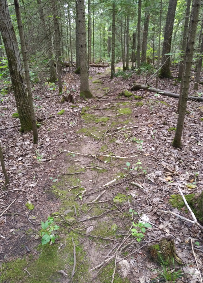
| Easily runnable and very pretty |
 |
| Neat rock stairs |
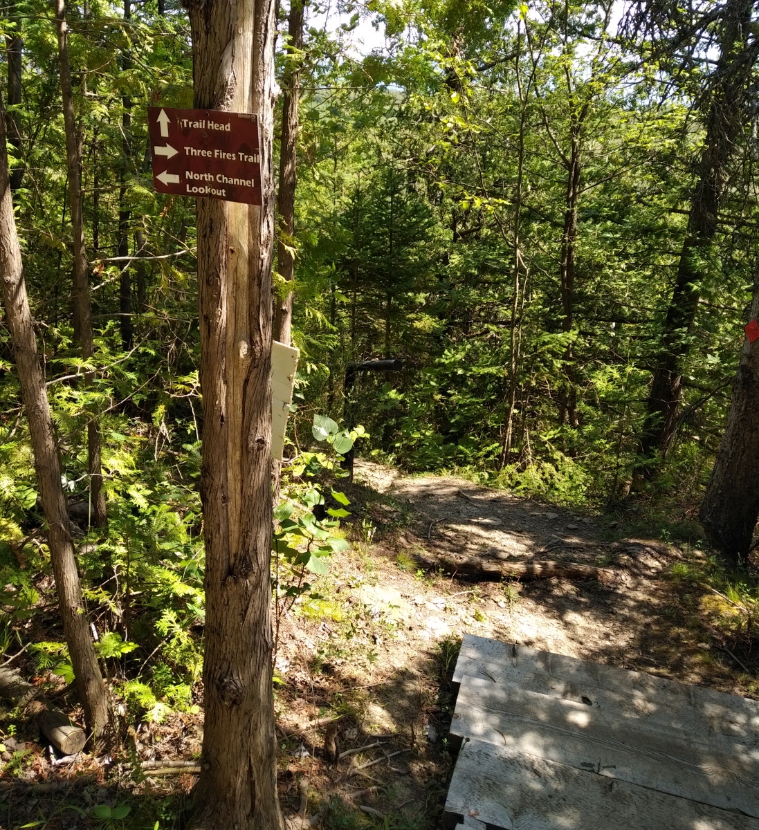
I had reached the place where the trail divides - left to the Three Fires Trail, right to the Warrior Trail
 |
| Forked up! |
 |
| I'd heard that "appropriate footwear is required" for this trail, but had no more information about its condition |
Turning left onto the Three Fires Trail, it immediately began to climb.
 |
| It would take a bit of work to get lost on this trail. |
The character of the terrain changed a bit here: less loose, more a mix of rock and grass.
 |
| The soil is so thin the trees remain a bit short and stunted. |
It was somewhere around here that I tripped on something and was going the heck down, but managed to catch myself on a springy sapling and stayed on my feet. My chronically sore hamstrings, though, absolutely
hated it.
 |
| Larger slabs of rock appearing underfoot were apparently not to my advantage. |
There are ATV trails that criss-cross the hiking trail, but signage warns riders to beware of pedestrian traffic.
 |
| Maybe my piercings would act as bear bells? |
If I'd expected to have an easier passage on the Warrior Trail, I was in for disappointment...but fortunately I enjoy a challenge!
 |
| This certainly fit the bill |
 |
| More agility course rocks, roots, and fallen sticks |
The east end of the loop brought me to the final lookout over the North Channel.
 |
| Local history |
 |
| This hole - enclosed by a fence - was the only trace I could see of the homestead. |
As the day grew hotter and more of my bug spray melted away with sweat, the mosquitoes intensified as I did my best to keep moving.
 |
| Not pictured: blood loss and itchiness. |
The trail, though, had other ideas - first it became a mess of tangled roots that I had to pick my way through.
 |
| Having already tripped once, I wasn't in a hurry to do so again. |
..then it went kind of full-blown dry stream bed on me.
 |
| RUN AWAY |
Then I spotted it - a second pile of fairly fresh bear poop.
 |
| Speaking of getting eaten alive.. |
So, more running away. I decided that maybe I should start singing something to keep any bears that might be in the area away (I couldn't just clap my hands as I was using a handheld water bottle), so I tried to think of something to sing. The only thing that came to mind was..
"If you go down in the woods today
You're sure of a big surprise
If you go down in the woods today
You'd better go in disguise!
For every bear that ever there was
Will gather there for certain
Because today's the day the
Teddy Bears have their picnic"
..because clearly my brain hates me.
 |
| Preparing to plunge into the woods. |
This bit was steep enough and sketchy enough that that actually put in a wooden guardrail...which was a bit wobbly. Out of all the wonderful infrastructure I saw along the way, this was the only bit that I really, really wished they'd put some more effort into keeping up.
 |
Tanker took this photo looking up the trail.
I think I was too scared of falling to pull out my phone as I minced my way down it. |
 |
Narrow: check
Steep: check
Rocky and uneven: check
Death to the left: big check |
Soon, though, I found myself safely at the bottom, and back to the neat stone stairs where the Three Fires Trail and Warrior Trail join the trail back to the parking lot.
 |
| All flat once you get past this! |
I was covered in sweat and mosquito bites, out of water (despite
Tanker having topped off my bottle a bit when I met him at the lookout), and absolutely delighted!
 |
| With a solid dirt tan to boot! |
After a bite to eat and getting changed, we made out way back out the long gravel road past the Wikwemikoong Waterfront.
 |
| Which also features a public beach in Smith Bay, but I knew Lake Huron would be awfully chilly for a cool-down dip! |
We stopped off at the Wikwemikoong Tourism office, and made a $10 donation while I raved about the trail and the work that has been done to give users such an excellent experience to the friendly folks there. When I said I'd run the Three Fires Trail and the Warrior Trail, the gentleman who seemed to be in charge's jaw dropped, with an exclamation of "You RAN it?" I explained that I'd run as much as I could without falling off anything or breaking my neck - it had taken me more than 1h35m of moving time to complete the trail loop, which came to 10k with my extra bit of tootling around the parking lot.
In any case, it was an awesome little adventure and I'd highly recommend it to anyone who finds themselves on Manitoulin Island. I hear there are actually guided hikes available for booking at the tourism office, with local guides who will teach you about interesting uses for native plants of the area and expand on the historical signage already on the trail. You can find more information either from the
Wikwemikoong Tourism website or the trail's
Facebook page - go on and check it out someday, whether for a run or just a challenging and rewarding hike!
 |
| And remember to stop and take in the views along the way. |


No comments:
Post a Comment
Go on, have at me!