..when they said "keeping your legs elevated is good for recovery".
 |
| Mine were elevated all weekend, but not exactly by sitting around in a recliner. |
We flew to Alberta on Friday evening, arriving in Calgary around 9pm MT and heading to
Tanker's parents' place for a meet-and-greet with some family from Nova Scotia whom he hadn't seen in 20 years (and I'd never met at all). Just before midnight we headed with his sister to her beautiful home in Cochrane, right in the foothills of the Rocky Mountains. By the time we rolled into bed around 1am I'd been up for more than 20hrs and was ready for a good long sleep..
..and then woke up at 6:30am MT to a frosty morning.
 |
| We left HEAT WARNINGS in Ontario! |
A bowl of oatmeal, a cup of coffee, and a bit of a warmup later I was off and running with my sister-in-law Krista's awesome crew - the
Cochrane Red Rock Running and Tri Club - down a lovely, groomed trail. We left at 8:30am from
Cochrane Coffee Traders and trotted along a lovely creek, through the
Cochrane Farmers' Market, then across a gorgeous footbridge.
 |
| Under the tracks with overcast skies |
 |
| This beautiful spot is where my in-laws get their family photos taken |
This is where things got interesting.
The group leader, Pete - a British fellow past his first youth with a wry sense of humour - asked if I'd like to go see some trails. Being a total puppydog when it comes to sightseeing on training runs, I followed along..
 |
..or should I say up?
(Photo taken when we returned later in the day; hence the sunshine) |
Cresting the ridge above the lovely, flat rail trail everyone else was running gave a beautiful view of the Big Hill Creek valley.
 |
| I could have just run along the bottom there.. |
 |
| But noooooo - apparently I just had to get up above the Ranche House. |
Then it was down, down, down again through the singletrack to cross over the creek.
 |
| Gorgeous rock forms |
 |
| Chasing Pete to the bridge over the creek |
We went the "wrong way" first so Pete could show me something Krista had told me about - the Grandfather Tree.
 |
| Even more impressive in person. |
Then we ran along a lovely trail through the pine forest before I made a near-fatal mistake: Pete asked if I'd like to continue on along the (fairly flat, creekside) trail or head up the ridge on something best described as a bunny track. Since Krista had mentioned the possibility of coming to run here again on Sunday, I figured I'd take advantage of having a guide and go up the ridge.
Public Safety Announcement: If an older British man ever asks if you want to go up the ridge, you say NO.
 |
| "You see that daylight up there?" he says..."That's where we're going." |
I had been anticipating a road run, so had worn my "dual-sport" shoes that are ok for roads and groomed trails. When I heard "It finally rained last week and things started growing, so we'll just bushwhack up this part here", I just kept telling myself that Krista trusted this guy to lead their group so he probably wasn't leading me off into the woods to skin me and dump my body.
 |
| Since this qualifies as trail, they'd never find me. |
I finally got to catch my breath when we made it up to the
Mt. St. Francis Retreat Trail, where they have the Stations of the Cross all set out along the trailside for penitents to walk and observe their faith. Despite not being religious, I may or may not have said a small prayer in hopes my heart wouldn't actually explode out of my chest.
 |
Pete being kind enough to wait for me.
Note that he's wearing ROAD SHOES. |
 |
Stations of the Cross.
Were I better versed in the Baptist faith I might have found them more enlightening. |
Then Pete says to me "now you'll get all that elevation back" before leaving me in his dust as he bailed down a steep, grassy decline. I fell quite far behind as it was impossible to see my footing and I couldn't risk turning my damaged ankle in the somewhat unstable shoes I'd worn.
 |
| It just kept going.. |
Reaching the bottom, the rest of the run was refreshingly flat - some through more pine forested trails:
 |
| Winding along the creek. |
Then we ducked under a "no trespassing" gate and ran over grassy hills in the morning mist as the sun began to rise above the foothills.
 |
| We met some folks coming the other way who didn't tell me to run for my life, so that was reassuring. |
 |
| Who am I kidding? I was having a ball! |
After awhile we turned around, heading back toward the Ranche House and then taking the groomed trail and dirt road "in deference to my shoes", Pete said. We got back to the café 90mins, 12km and 173m of elevation later to find Krista waiting for me, then headed home to have breakfast.
We headed out as a family - Krista, her husband Mike, their two fun kids, Tanker and myself - to the farmers' market to pick up some goodies, then hiked up to the cowboy statue just off the trail I'd run up earlier with Pete. I somehow managed to miss it completely, but I'm totally blaming
oxygen deprivation for that.
 |
| Up the hill on the left - the statue looking out toward Canmore on the right. |
Family stuff through the afternoon and into the night, then back up at 7am for another bowl of oatmeal to ward off the chill and then out into another frozen morning to chase the
Red Rock Runners.
 |
| Note to self: stay on the sunny side. |
Instead of leaving straight from
Cochrane Coffee Traders, we all drove up to Gleneagles and then ran down, down, down then over a couple of ridges and into
Glenbow Ranch Provincial Park.
 |
| With a view that couldn't be beat. |
While I believe the elevation (and maybe lack of sleep) had more of an effect on Saturday's run, I was definitely getting hit with the altitude on Sunday morning. I live in Cambridge, Ontario at a whopping 329m/1,079ft above sea level - Cochrane sits at 1,159m/3,802ft, so there was a difference of more than 830m/2,700ft and I could feel every inch of it. Apparently
even a moderate change of 580m can reduce VO2max by 5-7%, and when you add in the lingering fatigue from the
Haliburton 50 miler just 2 weeks previous, I felt like someone had strapped a cinderblock to my arse. Heck, I'm
not even used to running first thing in the morning!
 |
| Climbing from the bottom of the trail down from Gleneagles - most people ran up this! |
Still, the scenery kept me going, even after Krista decided to turn around at 4.5km, then some other folks turned around a bit later.
 |
| The path winding off through the ridges, with the Bow River down below. |
I pressed on to about 6.25km, when I came to a 3-way trail intersection with some construction vehicles visible. I decided I'd seen enough and didn't want to keep Krista waiting too long, so turned around and headed back past the remains of a couple of ranches.
 |
| Park sign near my turn-around |
 |
| Waverley Ranch remnants |
 |
| Incredible eroded hills along the North side of the trail |
I would have been happy with a bit more than 12km for the morning, but in my excitement on the way in I'd neglected to take note of a landmark - a big sign on the edge of the park where the trail splits. I thought I needed to turn right on the return trip as that was the more major looking trail, and I knew I needed to head up.
 |
| Down into the birch-forested coulée, then up to that clump of houses. |
Unfortunately, I ended up one ridge over on an even steeper section - even the deer footprints I saw were skidding!
 |
Which way to choose?
Trick question - they're both wrong! |
 |
| Pictured: an idiot. |
It turned out I was supposed to go straight past the sign, which Krista kindly let me know when I sent her a text to admit I was a bit lost. She and some of the other
Red Rock Runners - whom she wouldn't let leave until I was back on track (sorry guys!) - managed to direct me in. I had to go back down into the coulée - seeing some ice in a little drainage runnel down the side of one of the trails despite the right sunshine far above - then climb a totally different hill to get back up to Gleneagles, arriving after 14.5km in nearly 2hrs.
 |
| And I do mean UP to Gleneagles. |
 |
The view from up top is worth it, though.
Can you believe this is the tee box of the Gleneagles golf course? |
 |
| No getting lost this time. |
We moved to Calgary on Sunday evening for another family dinner and to let Krista and Mike return their household to normal after the weekend's chaos - there was work and school waiting for everyone on Monday morning. I, on the other hand, was up early once again (WHAT HAVE I BECOME?) to go explore some trails out my mother- and father-in-law's back door.
 |
| Can't beat that for a view at the start! |
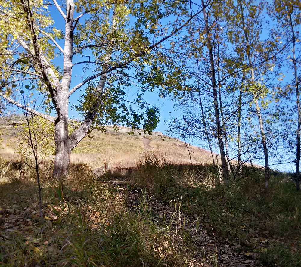
A bit warmer out this time: 5c instead of below freezing, but still very chilly as I picked up the scent of some singletrack and ran down into
12 Mile Coulée. I was feeling a bit more lively after a bit more sleep, and I'm sure my sister-in-law's excellent homemade pickled beets (of which I'd eaten a whole bowl the afternoon before) helped me make the most of the
thinner-than-my-flatlander-lungs-liked air.
 |
| Then as soon as I found this, I knew I was exactly where I wanted to be. |
As nice as it had been to have guides for my trail adventures so far in Alberta, I was delighted to be able to explore the singletrack in this deep, narrow valley on the edge of Calgary's Northwest corner on my own without any expectations.
 |
| A little death-to-the-left. |
 |
| Loving it! |
The fall colours were in full, stunning swing as I trotted along, stopping ridiculously often to take photos of anything that looked interesting...which was practically everything.
 |
| A ramp built over a deadfall tells me these trails are maintained by mountain bikers. |
 |
| Gorgeous sunshine and colour. |
It took me almost an hour to cover less than 7km -
I could easily have gone further, but there were starting to be too many trails diverging and I didn't want to get lost (again). So, I made it about halfway down to Nose Hill Drive then came back up, heading over to the Rotary Mattamy Greenway for a bit of a different route home.
 |
| Neat bridge in the distance |
 |
| See if you can guess which way I went? |
 |
| Yep, even despite the big hill. |
I was still feeling the altitude, plus the effects of the last couple of days of hard running - was certainly happy to have a bit shorter and easier trek for my last day in the foothills of the Rocky Mountains.
My other reason for keeping it shorter was because we had a much-loved relative to go visit in the hospital at lunchtime before we were due at the airport in the early afternoon. We were happy to be able to bring a smile to
Tanker's Aunt Carmel, even though it wasn't the reunion for which we'd hoped. All too soon, we had to head out.
 |
| With one last look at the Rockies past Canada Olympic Park. |
By 2:35pm MT we were taking off, and after a stop in Winnipeg (YAY) we were on the last leg of our journey home. I'm sure I didn't make too many friends on the plane ride.
 |
| "Stewardess? Can we get her a drool bib or something?" |
So there you have it - the official guide on
How NOT to Recover from a 50 Miler, as I arrived home just over 79hrs after we left work on Friday completely exhausted and ready to collapse.
Thing is, though, I wouldn't have traded those experiences for the freshest legs and rested mind in the world.
 |
| I'll sleep when I'm dead. |
And hey, I've still got a whole week until the
Sticks n'Stones 50k!


I bust out the tights when it hits 40s... I can't believe you're in a skirt at below freezing temps!
ReplyDeleteGorgeous pics. I love that rooty tree. Now that I have family in Wyoming I hope to get out to the Great Plains for some running and exploring.
The dry air out there doesn't feel as cold as it does in the soggy East - I usually wear knicks below 50f and tights below 30f, but admittedly after that one year at Horror Hill when it snowed and I saw ice building up on my bare thighs because I decided to race in a skirt (http://illadvisedracing.blogspot.ca/2013/10/horror-hill-6-hour-ultra-saturday.html) I've been a little more ambivalent to the cold on my legs.
DeleteI had also expected to be running later in the day on Sunday & Monday, so only brought 1 pair of knicks for Saturday morning. Wouldn't even have had the 2nd skirt with me, except it came in the mail to my office on Friday!
The Grandfather Tree was really amazing; glad I got to take a couple of pics as we'd meant to go back out for a hike to show Tanker, but there simply wasn't time. The Great Plains sound like an incredible place to explore!